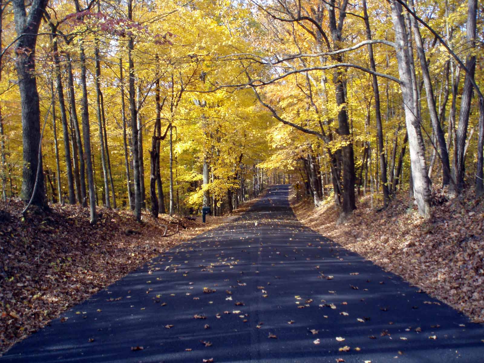
Mitch's Btown Blog

Bikes, Hikes, Music, Mushrooms

Retired boomer, out to walk my dogs, ride my bike, and hike the forest paths around Monroe County Indiana. Recently found ADHD runs in my family, and apparently gallops in me…


  • Here is an interview I did on WTTS about bike safety issues in Bloomington. They asked me as a member of the Bloomington Bicycle and Pedestrian Safety Commission, but I did not speak officially for the group, but for myself as a concerned biker/ped.

    I know I sound like Oscar the Grouch, but just today another pedestrian was killed while crossing the street, it was reported his shoes flew 40 feet. We just can’t keep giving cars the best parts of our lives, the streets should belong to the people, not the oil/gas/car/truck subculture.

  • Eileen and I vacationed in Chicago in August, and on the first day we rented a tandem bike at Millennial Park, and started riding north. We found the path a bit crowded, but everyone seems to get along fine, no crashes. We passed the volleyball courts, and rode out on a pier. I got my feet wet, and we gazed at the water.

    From Chicago/Prairie Vacation '09
    From Chicago/Prairie Vacation '09
    From Chicago/Prairie Vacation '09

    We rode west at Diversy, and toured the lagoon north of Lincoln Park zoo, then entered and bikes around the animal houses.

    From Chicago/Prairie Vacation '09

    We followed the zoo parking lot south, then walked over the ped bridge over Lakeshore Drive. It had no screens around it, and in fact there were flowers all the way across.

    From Chicago/Prairie Vacation '09

    We move back down the lake path to the Chicago River, then rode across the bridge, which is quite a scene, bikes, skaters, peds, and cars all sharing the space. We got back within our 2 hour rental time even though we goofed around a bunch at the lagoon and zoo.

    From Chicago/Prairie Vacation '09

    We stopped at the band-shell and listened to a rehearsal for a bit, then got on the train and headed back to Schaumburg and the prairie.

  • I began the relaxing hobby of bee petting couple of years ago, after reading about the idea in one of Tom Brown, Jr.’s books. (This is not for you who allergic to bees, you know who you are.)

    It helps to have love in your heart for the bees, they are very cute, and important in the web of life. They act a bit like cats, standoffish and cool, obviously they have better things to do than mess with humans. But they will allow you to pet them, if they have time!

    I’ve been petting bumble bees at Sprouts Garden in the hyssop and mint patch. These are big ones with lots of fuzzy hair, black bodies with a yellow spot on the back that is widely variable in size, shape and intensity of color. They flit from flower to flower, grasping the plant with with there four back legs. Once settled, they extend their probiscus into the tiny flowers. Then they use their smaller front legs to pull the flower up over their heads so they can reach the nectar at the bottom, it is quite amusing to watch.

    Most of them are predominantly black, some who are mostly yellow. Some have all black thoraxes, others are striped. Some are big, some little, and all are busy (as a bee).

    These are such focused little creatures! I sometimes accidentally push them off route while trying to pet them. They make an extra buzzing sound, then rush off to the next flower. They are not easily diverted from their tasks, even by a giant trying to stroke their fuzzy little backs. Stinging me is the last thing on their tiny minds, of this I am sure.

  • Waterfalls are special places, maybe it’s the ions, the water vapor, the sound, the whole experience is magical, waterfalls have a spirit, and each one is unique.

    This waterfall runs most of the year, and is visible from Mt. Gilead Rd. The small branch that falls into Stephan’s Creek runs for about a half mile till it attains the Mt. Gilead Ridge. There are not that many waterfalls in Monroe county, I hope on visiting them all this year, but I don’t know where they all are. Let me know of any you are aware of, I would love to take a shower in each and everyone this summer.

  • An easy ride to the southwest side of town, the Leonard Springs Nature Park is a great getaway, and Jojo and I biked out there last weekend. The water was flowing really well, the waterfall below the springs was loud and proud. I think this is the best waterfall in the county, anyone know of others that are better?


  • Yellow Lady Slipper

    After our great Virginia bluebell find last week, I was anxious to get to the Morgan-Monroe forest, where in years previous I’ve found the rare yellow lady-slipper. It was Sunday morning and we figured the highway would be pretty empty, so we headed out 10th St., and rode SR. 45 straight out to Tunnel Road, which we took to Shilo Rd, less than an hour of steady riding.


    Shilo Rd. was repaved last year, and is still in great shape, a fine 3 mile ridgetop ride in the forest. We stopped for a break at Rust Rd., and has luck would have it Jason and Aaron Breeden came down the road, stopped and chatted for a few minutes. Jojo and I rode on to where Shilo ends on Anderson Rd., which we took over to Bean Blossom Rd. This road runs up the valley and then ascends nearly 300 feet over to the ridge which divides the White River from the Bean Blossom Valley.

    After climbing the first long incline, there is a level stretch of ridge that drop steeply on each side. Right where we found them 2 years ago were the same 2 clusters of the elusive Yellow Lady Slipper. I took some pictures, they are here. We climbed to the top, and headed west on Forest Road, and to our surprise we saw several other clusters of Lady Slipper on the north side of the road.

    As we rolled along enjoying the crisp green, forest air, we came on a clear-cut right along the roadside, with a sign that just flabbergasted me, I can’t believe they are so ignorant!

    We rode Old 37 back to town, coming in through Cascades Park, about a 30 mile loop, really satisfying with just 2 big climbs, Bean Blossom and Firehouse hills. The weather was perfect, and the ephemeral wildflowers were at their peak.

    From Mitch’s Bike Maps
    OLYMPUS DIGITAL CAMERA

  • [Updated Sept 5]

    I’ve been using Google Earth for the last year to line out new rides, and by measuring the distance and elevations of the various hills, I’ve come up with Mitch’s Hill Toughness Quotient (MHTQ). The formula is simple, I divide the rise in elevation feet by the distance in miles, this is essentially a steepness quotient. The climbs I have here are all over .2 miles, and the rises from 138-318 ft. I’ve included both paved and gravel roads. Gravel is harder to climb, but I am not sure by what factor. For me, some are impossible, my back wheel starts to spin out, even with a bunch of weight in my pannier.

    These numbers are a steepness quotient, and other factors must be considered in saying how hard a hill is to climb. Consider Brummett’s Creek Rd., which has a high number at 608 over 1/4 of mile, while everyone would agree that Bear Wallow Hill Rd. (424 MHTQ), which rises 324 feet in 3/4 mile really is a bear. More climbing, more distance, more work. So in some cases rising steeply for a short distance may be easier that a long climb.

    I have been updating this list, and as of now Brummett’s Creek and Mt. Gilead (east) hills have risen to the top of the paved list (discounting Miller and Boltinghouse, which are still far and away the toughest paved hills).

    THE TOP FIVE TOUGHEST HOOSIER HILLS

    #1 McGOWEN ROAD

    No way around it, this gravel hill leading to Gilmore Ridge is the toughest Hoosier Hill I’ve been on. Just southeast of Pine Grove on Lake Monroe, McGowen (aka Rogers) Road rises a whopping 250 feet over just .27 miles, giving it the top score of 926 MHTQ. I’ve since figured out that it is much easier to go up TC Steele Road and down McGowen Road rather than up!

    605 to 855 feet
    250 ft rise
    .27 mile
    250/.27=926 MHTQ

    From Crooked Creek_McGowen Ride

    Second and third place (by the numbers) go to Miller and Boltinghouse Roads. Boltinghouse has had the reputation as the toughest paved hill, but I have checked my numbers thrice, and Miller is the winner by a nose.

    #2 Miller Road
    616-820 feet
    204 ft. rise
    .27 mile
    204/.27=775 MHTQ

    #3 Boltinghouse Road
    629 to 820 feet
    191 foot rise
    .25 mile
    191/.25=764 MHTQ

    Number four is Earl Young Rd, and being gravel, it may harder than either Miller or Boltinghouse. I haven’t put a number on gravel vs. paved, but my guess would be about 100 points. If you have experience on these roads what do you think? Is Earl Young tougher than Miller or Boltinghouse?

    #4 Earl Young Rd
    694 to 874, 180 ft rise
    .27 mile
    180/.27= 666 MHTQ

    Number five is in Brown county, Indian Hill Road off of SR 45. This may also be tougher than Miller/Boltinghouse, as it is gravel, longer, and higher than the other top 5, and so although it is a few points lower than Brummett’s Creek, it rates #5.

    #5 Indian Hill Rd.
    640 to 876, 236 feet rise
    .39 mi.
    236/.39= 605 MHTQ

    Below is a listing of some well know hills, I’ve climbed them all on my recumbent at one time or another, and wanted to know where they were in the scale. I placed them in order, with Brummett’s Creek at the top, and to my surprise, Firehouse Hill at the bottom. (It seems tougher than it is as it is so often the last big hill of the day.) If you have any hills that should be on this list, let me know.

    Brummett’s Creek Rd.
    770-630=140 ft rise
    .23 miles
    140/.23=608

    Mt. Gilead Road (West)
    836- 630=206 ft rise
    .39 mi
    206/.39=528.2

    Schwartz Ridge Road
    715-577=138
    .25 mi.
    138/.25=522

    Bean Blossom Road (the first main climb)
    630-820 190 feet
    .39 mi.
    190/.37=487

    Mt. Gilead-(East)
    803-660=143 ft rise
    .29 miles
    143/.29=493

    Bear Creek Hill (Gravel)
    738-907 169 rise
    .35 mi
    169/.35=483

    TC Steele Road
    560-860=200 feet
    .42 mi.
    200/.42= 472

    Crooked Creek (Gravel)
    595-860, 265 ft rise
    .6 mi
    265/.6=441

    Bear Wallow Hill
    692-1010, 318 ft rise
    .75 mi
    318/.75=424

    Old Meyers Road
    610-790, 180 ft
    .46 mi
    180/.46=391

    SR 446 North of causeway
    560 to 728, 168 rise
    .44 mi.
    168/.44=382

    Lampkins Ridge
    565 to 705, 150 foot rise
    .4 mi.
    150/.4=375

    Paynetown Road
    540 to 728, 188 ft rise
    .52 mi
    188/.52=361

    SR 446 south of the causeway
    560-750, 190 ft rise
    .56 mi.
    190/.56=340

    Firehouse Hill
    601 to 791, 190 ft rise
    .65 miles
    190/.65=262

    Bean Blossom Hill (the full climb)
    630 to 923=293 ft rise
    1.29 miles
    293/1.29=227 MHTQ

  • When I first started taking longer rides in the country, I worked out several loops that I could do before work at 10 am. One of my favorites was the 23.6 mile loop that included 3 miles in the Kerr Creek valley, and 3 miles along Brummett’s Creek.

    Jojo and I were starting late on Saturday, and wanted some good long miles in the country, and so took the Grimshaw Trail towards 446, and then sped down SR 46. Fortunately the highway has a couple of feet outside the lines, making the stretch less stressful than it could be. A bunch of jerks leaned out their window, honking and yelling at us, but that can happen anywhere. Some cars drivers appear to be antagonistic to bike riders, are they somehow threatened by the athletic prowess of 2 graybeards?

    Kerr Creek was repaved last year and is now smooth and quick, the hill can be done with no brakes. It runs eastward to Getty’s Creek Rd. Getty’s Creek runs up over the shoulder of the ridge, offering a great view of the valley, before ending at SR 46. It is just a short hop on highway 46 to Birdie Galyon road.

    Birdie Galyon rises steeply through a beautiful dark valley, and then connects to Fleener Rd and back down the hill, brakes are required as there is a steep curve at the bottom. Fleener Rd. tees onto Hash Rd., which then runs up to Brummett’s Creek.

    From here Brummett’s runs through 3 miles of scenic farm country before climbing to the ridge for another mile and a half of ridgetop riding, till it ends at SR 45. Last year at this time, Lake Monroe was near capacity, and the valley was flooded and filled with herons and ducks, rather than corn and soybeans. We crossed the creek and found the Valley of the Bluebells, what an amazing sight/site! We found a colony of these last year along Woodland Road, this year’s find was massively larger.

    Once we reached SR 45, we decided to take it all the way back to town, which can be harrowing at times. If you don’t mind adding half a mile, Mt. Gilead is much more pleasant to ride, but we were tired, and Mt. Gilead is a bear to climb

    I’ve been plotting hill climbs via MHTQ (Mitch’s Hill Toughness Quotient), and Mt. Gilead is at 582 MHTQ, beating all the paved roads I’ve measured except the undisputed champions, Miller (775 MHTQ), Boltinghouse (764 MHTQ) Roads, and (in a different class) Brummett’s Creek (608 MHTQ), which we had just climbed.

    All gravel McGowan Road is still the champion at 926 MHTQ. It only took one climb to make me realize it is considerably easier to go down McGowan than it is to go up!).

    From Mitch’s Bike Maps

  • On Saturday, Jojo and I went for a bike ride east of Bloomington, and while hiking in the Yellowwood forest found the motherload of bluebells (Mertensia virginica). Two weeks before we had ridden to Woodall Road where we had found them last year, but no luck, and a lot of hill climbing resulted. But this cool clear spring day we encountered a side valley that eventually rises to Scarce o’ Fat ridge.

    All along the forested valley floor the bluebells were only plants visible, with an occasional buckeye sprout rising above the carpet of blue flowers and magenta buds. There was a dry branch running through the middle, and we walked up it a few hundred yards and sat on a log to admire the etheric glow of the bluebells. Right next to us I discovered a rare plant which did not turn blue once it flowered. (The bluebell buds are magenta when they appear, then as the flowers grow out of the buds, they morph to the a vibrant deep blue.) The pink bluebell seemed to be pretty rare, of the tens of thousands of flowers in the valley we saw only 2 pinks, and they were close together.

    I’ve heard from others that this has been a good year for bluebells, they certainly did like this spring. They are perennials, but also spread from seed that is not easily dispersed. This means that they take over whole areas of a forested flood plain; here they were even beginning to climb the hillside, not their normal habitat.

    We walked up the dry branch into the Valley of the Bluebells | Flowers 2009
    Bluebells morph from Magenta to Blue | Flowers 2009
    Rare pink Virginia Bluebell | Flowers 2009
    I’ve always found some phlox growing with a colony of bluebells | Flowers 2009
  • We took off a bit late at 3 pm, and headed out for Bottom Road. We usually ride through Cascades Park, now that the speed limit is 20 mph, it feels really safe for bikes. The climb past the monastery is short enough that you feel good and warmed up by the time you crest the hill, yet not worn out. We rode out Kinser Pike to Bottom Road, and headed north. Its about five miles of “flat” riding up to the intersection of Woodall Road. We rode Woodall for a while, then took a right on Woodland Road, which rises out of the valley, and then took Barr Road again dropped into the Bean Blossom valley, and to our suprise we found a dry waterfall with a large pool below.


    It was quite interesting how the water was totally contained by large rocks, even though it was dry uphill and downhill from the site. My camera had a finger smudge, so my pictures aren’t that great, but I posted them anyhow.

    Both Barr and Woodland Roads end on Mt. Tabor, which is fast busy road. We rode a short distance to Cowden Rd, which runs east for a mile or so, a quiet residential ridgetop ride. We debated taking Union Valley to Maple Grove West, but they are both fast busy roads, so chose to take the longer Delap Road loop to the beginning of Maple Grove Rd North. (Yes there are 2 Maple Grove Roads, and they intersect at right angles!)

    Delap runs the ridge for a while and offers some great views of the Bean Blossom valley. We passed a farm with peacocks and llamas, very scenic in the early evening sunlight. Where Delap drops into the valley we found a cascade/waterfall, probably spring fed, as it was running strong. We stopped to explore and found that there were two parts, dropping about 15 feet. This video should give you an idea of what if was like:

    Maple Grove goes generally south, crosses the east/west Maple Grove, and then ends on Arlington Road. We rode up and up a long climb after 30 miles. Even though it is not a steep grade, Arlington Rd. rises over 150 feet (701-855 ft) as it climbs past Hoadley Quarry and over SR 37 and then the Bypass. We were tired, but happy to have been out over four hours and found new places to enjoy.